Byway 12: Epic Road Trip in Southern Utah
- solarastills
- Jul 28, 2025
- 10 min read
Updated: Jul 29, 2025

If you ever need a reminder that Earth is a show-off, Utah's Scenic Byway 12 is it. When people think of southern Utah, they usually picture Zion and Bryce - and that’s where they stop. But there’s so much more beyond Bryce Canyon. Scenic Byway 12 runs for about 120 miles through some of the most geologically diverse and underrated parts of the state, bookended by Bryce Canyon NP at one end and Capitol Reef NP at the other. We spent four days tracing the "stairs" of the Grand Staircase of Escalante, and it turned out to be the kind of trip that makes you rethink your idea of the desert.
Got a question about this road trip that you need answered quickly? DM me on Instagram @SolaraStills and I’ll be happy to help! I only accept DMs from followers, so hit the follow button before sending.
How To Get There
From San Francisco Bay Area, the easiest route is to fly into Las Vegas or Salt Lake City and rent a car. We flew into Vegas and started driving towards Utah, with a quick stop at beautiful St.George for lunch, before heading into the mountains.
Car Rental
If renting a car for the trip, I highly recommend renting a 4WD, as some of the sights and viewpoints along Byway 12 can only be accessed via unpaved roads. Although a sedan may do the work, it is best to have a high clearance vehicle, especially if the road is muddy from recent rains.

Audio Tour
Using an audio tour on Scenic Byway 12 made the drive a lot smoother and more interesting. We used the Action Tour Guide for Grand Staircase-Escalante. It worked well as it gave clear directions and pointed out stops we might’ve missed otherwise. As we drove, it automatically kicked in with short stories, local history, and tips for pullouts or quick hikes. No need to keep checking maps or searching online.
Where To stay
Since Byway 12 is over 120 miles long, end to end, you may want to divide your stay between Bryce Canyon City at one end and Torrey at the other. We, however, decided to stay at Bryce Canyon City the entire stay and drive back and forth on 12 each day. We stayed at Ruby’s Inn, which is a classic spot with quick access to Bryce and some solid food options, including free breakfast at the Ebenezer Barn & Grill.
Where To Eat
Although there are numerous places to eat along Byway 12, most eating options are located in Bryce Canyon City, Tropic, Canonville and the town of Escalante. Most notably, we loved eating at Canyon Diner in Bryce Canyon City, The Pizza Place in Tropic and Escalante Outfitters in the town of Escalante.
Cedar Breaks National Monument
Cedar Breaks National Mounment is not located along Byway 12, but a few miles to the southwest, along Hwy 148. It's often skipped, but worth the detour. Cedar Breaks National Monument feels like Bryce but with fewer people and a more relaxed vibe. The views from the rim are wide and clear, and the rock layers are part of the upper steps of the Grand Staircase. We stood at over 10,000 feet, looking out at a natural amphitheater bursting with fiery red and orange hoodoos, made even more dramatic by the early afternoon light. Pro tip: bring a jacket. Even in summer, it gets chilly up there.



Red Canyon State Park
Red Canyon is one of the first places you pass on Scenic Byway 12, and it’s a great intro to southern Utah’s red rock country. We stopped there before heading toward Bryce and did the Arches Trail. This is a short loop that winds through rocky hills with natural arches and windows carved into the stone. The trailhead can be reached after driving for 2 miles on an unpaved road, and so, having a high clearance vehicle is very much advisable. The trail climbs up through a dry wash, past a small stone shelter that’s rumored to be a Butch Cassidy hideout. Along the way, we spotted more than a dozen arches, some big enough to stand inside. It’s a quick hike, but it gives you a chance to walk right up to the formations and take in views of the valley below. Definitely worth the stop.


Red Rock Arches of Byway 12
Driving along Byway 12 in Utah, as you pass Red Canyon, you will notice a pair of red rock arches that stretch over the road in Red Canyon. They’re built right into the landscape, and you pass through them just after leaving Panguitch. It’s a quick moment, but it marks the start of the route and gives you a sense of what’s ahead - miles of rock formations, cliffs, and winding roads through canyon country. It’s a simple but memorable part of the drive.

Bryce Canyon National Park
Bryce Canyon National Park, is the Queen Bee of Byway 12 and one of "Utah's Big 5 NPs" (The others are Zion, Arches, Canyonland and Capitol Reef NP) It sits on the second stair of the Grand Staircase, a massive geological formation that stretches across southern Utah. The park is known for its hoodoos, which are tall rock spires formed by erosion. Watching the sunrise from the rim is quiet the experience as the light slowly reaches into the canyon and touches each formation. This is one of our favorite National Parks in the country, just because of its irresistible charm and uniqueness when compared to the others. Having visited it for the first time on July 2nd of 1995, we decided to revisit exactly 30 years to the day and recreate some of the memories we had captured 30 years ago.


Navajo Loop Trail (Bryce Canyon NP)
Navajo Loop Trail, a 3 mile loop in Bryce Canyon NP, is one of the most popular hiking trails in the park. It is best done early in the morning, or closer to sunset, to beat the heat, as it can get quite steamy in the valley. We started the Navajo Loop Trail at Sunset Point and followed the path down into the canyon. The switchbacks were steady and took us past tall rock walls and scattered trees. At the bottom, we walked through the section with the Twin Bridges, two stone arches that stretch across the trail. From there, the trail curved through the canyon floor with views of hoodoos rising around us. We reached the Wall Street section, a narrow passage with high rock walls and tall fir trees growing between them. The climb back up was slow, with tight turns and a steady incline that brought us back to the rim. The loop gave us a close look at the formations from below and a chance to see how the light changed as we moved through the canyon.



Mossy Cave and Falls
Mossy Cave Trail is a short hike just off Byway 12 near Bryce Canyon that gives you a chance to see hoodoos from a distance, a waterfall, and a cave-like grotto. The trail follows a stream called the Tropic Ditch, which was dug by Mormon settlers in the late 1800s to bring water from the East Fork of the Sevier River to nearby towns. The waterfall along the way is a part of that irrigation system and still flows today. The cave at the end isn’t a true cave either, but a shaded alcove where water drips from the rock and moss grows year-round. In winter, it fills with icicles. The trail is easy to follow and crosses a couple of bridges before splitting, with one way that takes you to the waterfall, the other to the cave. It’s a quick stop but gives you a good look at how people shaped the land and how nature continues to change it.
Kodacrome State Park
Kodachrome Basin State Park is located just off Byway 12 near the town of Cannonville. Since this is a state park, our "America The Beautiful" park pass did not come handy, and we paid $10 for entry into the park.The park is known for its tall stone spires called sedimentary pipes, which rise from the ground and stand out against the surrounding landscape. These formations were created when ancient springs filled with sediment and hardened over time. As the softer rock around them wore away, the pipes remained. Kodachrome got its name in 1948 when a National Geographic team visited and thought the colors looked like the ones captured by Kodachrome film. It’s a quiet place to walk, take photos, and see how the land has changed over millions of years. We did not hike here, but drove around to see the unique spires.
Escalante National Monument - Willis Creek Slot Canyon
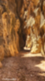
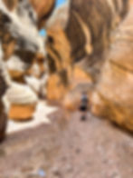
Willis Creek Slot Canyon is a hike in Grand Staircase-Escalante National Monument, off Byway 12 near Cannonville. To reach the trailhead, we had to drive about 6 miles down a dirt road that was rough in places and required a high-clearance vehicle.
The hike itself follows a shallow creek through a narrow canyon. The water is usually only a few inches deep, depending on the time of the year, and if it had recently rained, and you may need to step through it or hop across rocks. The slot canyon section lasts for about 2 miles, after which the canyon opens up. Most people turn around at that point, making the hike about 4 miles round trip. Having seen red slot canyons near Page, during prior trips, this sandstone slot canyon was a unique experience for us.

Kiva Koffeehouse
Kiva Koffeehouse is a café located off Byway 12 near milepost 73, close to Escalante.The building has large windows and a patio where people can sit and look out over the Escalante River Canyon, at one of the best views along 12. From there, you can see cliffs, layers of rock, and trees below. The view stretches across the canyon and shows how the land changes with light and time. We stopped here during our drive to Capitol Reef NP to take a break and enjoy the view while having coffee. The café is open seasonally from April through October.

Burr Trail
Driving the Burr Trail near Byway 12 takes you through a remote area that connects Boulder to Bullfrog Marina on Lake Powell. The road passes through Grand Staircase-Escalante National Monument, Capitol Reef National Park, and Glen Canyon National Recreation Area. It starts as a paved road in Boulder and turns to dirt as you enter Capitol Reef. The full route is about 67 miles long. We drove through only part of this historic road and turned back after Singing Canyon.
The Burr Trail was first created in the 1800s by John Atlantic Burr, who used it to move cattle between summer and winter grazing areas. In the mid-1900s, the Atomic Energy Commission built a rough road through the area to search for uranium, which led to the creation of the Burr Trail switchbacks. These switchbacks climb and descend steep rock layers and are still part of the route today. It’s a quiet road with places to stop, walk, and take in the land.

Singing Canyon
Singing Canyon is a short slot canyon located along the Burr Trail, about 11 miles from Boulder, off Byway 12. The canyon is easy to reach from a small pullout on the side of the road. It’s known for its strong echo, which is why people call it Singing Canyon. Visitors often stop to clap, sing, or speak inside the canyon to hear the sound bounce off the walls.

The Hogback
One of the most memorable parts of Byway 12 is driving the Hogback. This section of road runs along a narrow ridge between the towns of Escalante and Boulder. On both sides of the road, there are steep drop-offs with views of deep canyons, cliffs, and winding streams far below.
Before the road was built, Boulder was the last town in the United States to receive mail by mule train. The new road built in 1940 allowed mail and supplies to reach the town by vehicle year-round.

Heritage Overlook
Although there are many pullouts and scenic viewpoints along Byway 12, the most scenic of them all is the Heritage Overlook. From this point, you can see the road as it curves and drops through the canyons, showing how it winds through the terrain. It gives a clear view of how the highway was built to follow the shape of the land rather than cut through it.
Capitol Reef National Park
Capitol Reef National Park is located near the eastern end of Utah’s Scenic Byway 12, close to the town of Torrey. It’s one of Utah’s “Mighty 5” national parks, along with Zion, Bryce Canyon, Arches, and Canyonlands. The park was made a national monument in 1937 and became a national park in 1971. It protects a long stretch of land called the Waterpocket Fold, which is a large wrinkle in the Earth’s surface.
One of the well-known rock formations in Capitol Reef is Chimney Rock. It’s a tall, narrow spire that stands about 300 feet above the road and was formed by erosion over time. Visitors can see it from the road or hike a loop trail that goes around the mesa where it stands. There are numerous trails to explore in the park, many highlighting the life of the Native Americans and early settlers, as well as some well preserved petroglyphs.

Hickman Bridge (Capitol Reef National Park)
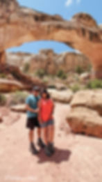
Hickman Bridge is one o the iconic sights to see in Capitol Reef National Park. The trail to Hickman Bridge starts near the Fremont River, just off Highway 24, about two miles round trip and begins with a steady climb before leveling out. As you get closer, the natural bridge comes into view. Hickman Bridge is a large stone arch that was shaped by water over time. The trail leads under the bridge and loops around, giving you a chance to see it from different angles. The hike is easy to follow, but I highly recommend doing it early in the day or later in the evening, as the trail is fully exposed and the midday sun can be quite harsh in the area.
Got a question about this road trip that you need answered quickly? DM me on Instagram @SolaraStills and I’ll be happy to help! I only accept DMs from followers, so hit the follow button before sending.
After miles of winding roads, quiet towns, and trails that led to unexpected views, Byway 12 gave us more than just a drive; it gave us time to slow down and take it all in. From Bryce Canyon to Capitol Reef, each stop had its own rhythm, its own story. Whether it was a quick roadside pullout or a long hike to a hidden waterfall, the road kept offering something new. If you’re thinking about taking this route, don’t rush it. Let the land set the pace. And when you reach the end, you’ll realize it wasn’t just about getting somewhere; it was about everything in between.


